The Compromise of 1850 was one of the major events leading to the American Civil War. It was a set of five bills proposed by Republican Senator Henry Clay and supported by his counterparts Daniel Webster and John Calhoun...
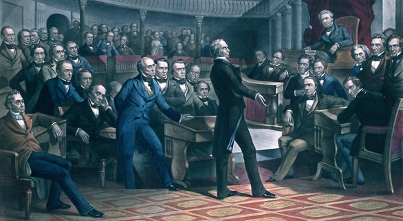
The Compromise of 1850 was one of the major events leading to the American Civil War. It was a set of five bills proposed by Republican Senator Henry Clay and supported by his counterparts Daniel Webster and John Calhoun...
Huge land deals and sectional views over the spread of slavery into the new territories were splitting the nation and threatening peace in antebellum America. The first time a petition for the abolition of slavery was brought up to Congress was in...
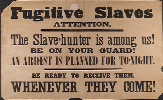
The Fugitive Slave Act of 1850 allowed the capture and return of fugitive slaves to their rightful owners within the territories of the United States. It was one of the five acts included in the According to the US Census the number of slaves...
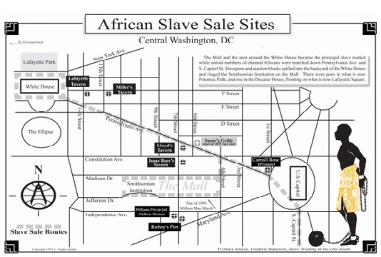
As the nation’s capital moved from Philadelphia to Washington DC in 1800 more slaves were needed to build the infrastructure required for the new capital. Alexandria became one of the largest slave trade markets in the US with Franklin &...
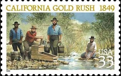
The Compromise of 1850 admitted the State of California as the 16th free state of the Union. After the US-Mexico War the territory of California was governed by the military. Starting in January 1848 people from all over country and from foreign...
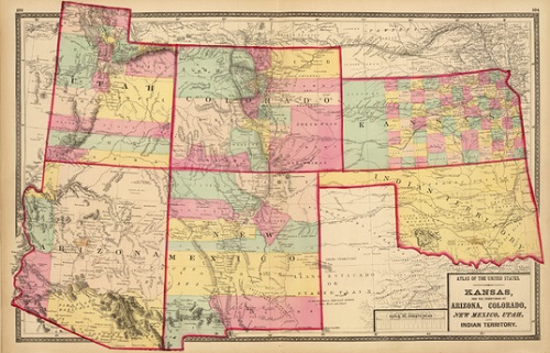
The land of the territories of New Mexico and Utah were organized by the Compromise of 1850. Most of the land was gained in the Mexican-American War and under the Treaty of Guadalupe Hidalgo it was transferred to the United States. The other part of...
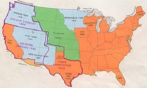
Texas was annexed by the US in 1845 becoming the 26th state. It entered the Union as a slave state, its Constitution considered illegal the unauthorized manumission of slaves in its territory. Texas was already the largest state in the United States...

The Missouri Compromise of 1820 was an attempt to draw an imaginary line on the 36°30′ latitude to limit the spread of slavery to the north of that boundary. Missouri Compromise 1820 Click on...
An Unpopular Decision: The Dred Scott Decision. Short documentary by the History Channel.
The Raid of Harper’s Ferry. A short documentary by the Smithsonian Magazine.
Video by Teacher Tube